Before a borehole is drilled, the most important question is simple: will it work? Our hydrogeological assessments give you that answer with science-backed certainty. By combining geological mapping, aquifer characterization, and water quality analysis, we provide a clear, data-driven picture of your groundwater resources. The result: fewer risks, smarter investment decisions, and higher borehole success rates.
Our Methodology
Geological mapping
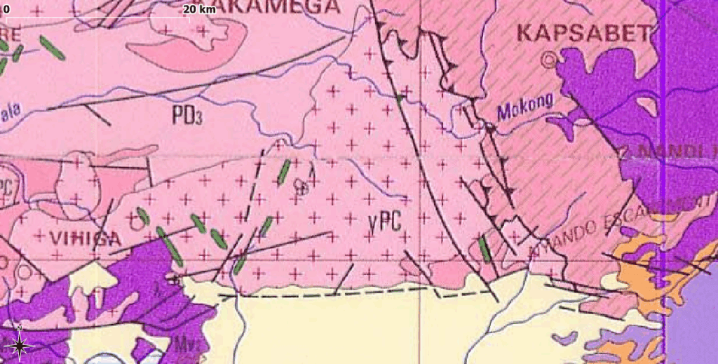
We begin with detailed fieldwork and desk studies. By walking the terrain, examining rock types, and cross-checking geological maps, we identify fracture zones and formations where groundwater is most likely stored.
Aquifer Characterization
Through data from nearby pumping tests, we assess key aquifer parameters like transmissivity and storage capacity. This tells us how much water can be sustainably pumped- ensuring your borehole delivers for years, not just months.
Water Quality Analysis
Safe water is as critical as abundant water. We review existing records and, when necessary, conduct field sampling to detect salinity, hardness, or contaminants. This step ensures your borehole produces water that is both usable and compliant with Kenyan standards.
Why Hydrogeological Assessments Matter
- Drilling a dry borehole
- Hitting water that requires expensive treatment
- Overpumping an aquifer that quickly runs dry
When done correctly, hydrogeological surveys do more than reduce risks — they open opportunities. For example, naturally mineral-rich water sources can be developed for premium bottled water products.
Beyond Hydrogeology: Go Deeper with Geophysics
Sometimes the subsurface story is more complex than hydrogeology alone can reveal. That’s where geophysical surveys add value – penetrating deeper, resolving hidden aquifers, and increasing confidence in drilling decisions.